A trip to Afghanistan allows you to visit a country that has been largely ignored by mass tourism for the past 40 years. It allows you to engage with people and see locations that only a few people would ever see. Afghanistan has a fascinating ancient past, a fascinating recent history, and a welcoming local community.
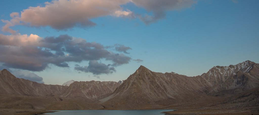
Despite the fact that travel in Afghanistan can be difficult, the country’s snow-capped Pamir mountains and verdant valleys have enticed curious explorers for a long time. On this heroic journey, join us in 2021 for an exclusive expedition to the world’s first winter seven thousander and Afghanistan’s highest mountain, the Noshaq Climb
Reveal the Wakhan Corridor’s amazing ecosystem and discover how this area of the country is known as the “modern silk path.” This 30-day adventure will take you through the wild life, valleys, rivers, passes, and pastures of the pure Afghans, starting and finishing in the vibrant Qazideh Valley. In the summer-quarter highlands, stay in a nearby guesthouse. Wash in springs fed by magma deep within the earth’s crust. Look for the popular Marco Polo sheep, ibex, brown beards, and a variety of other animals. This journey brings you deep into the heart of a world where the inhabitants live a true indigenous nomadic lifestyle.
The Wakhan Corridor, located in Afghanistan’s north-eastern edge and encircled by Tajikistan to the north, Pakistan to the south, and China to the east, is a stand-alone travel destination. The purpose of this excursion is to climb the Noshaq, Afghanistan’s highest peak. We intend to drive from Dushanbhe to the Wakhan Corridor and then back to Tajikistan via Shughnan.
It’s worth remembering that traveling in Afghanistan’s Wakhan National Park, one of the country’s most protected regions, is neither comfortable nor leisurely. The combination of long days, steep and rugged paths, and peak altitudes reaching 7492m creates a daunting tour in one of the world’s most remote and culturally satisfying locations.
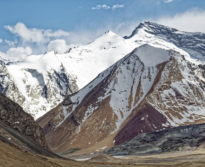
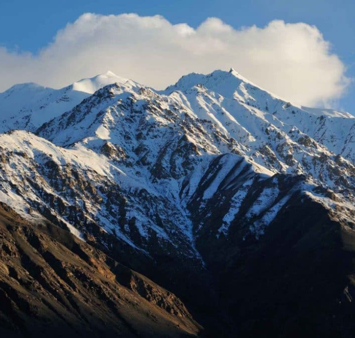
Noshaq Peak is located in the Hindu Kush Range at an elevation of 7,492 meter (24,580 ft) near the Afghanistan-Pakistan border. It is the highest peak in Afghanistan and the second highest peak in the Hindu Kush after Tirich Mir.
The best way to approach the Noshaq Peak Expedition is through the Qazideh Village which is 16 hours away from Kabul by road or 2 hours by air. The beautiful peak is also accessible from Chitral District of Khyber-Pakhtunkhwa of Pakistan but it is a very much tough climb from there. Not to mention prices are simply double the cost of Qazideh!
The first ascent to this Hindu Kush peak took place in 1960 which was carried out by a Japanese expedition led by Prof. Sakato. The winter ascent of Noshaq Peak also makes an interesting expedition because it was the “First Winter Climb of any 7000m peak” carried out by a Polish Expedition in 1973 and has been the only winter ascent of Noshaq Peak since then.
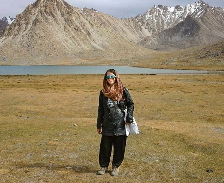
Recently, in July 2019, a group of spirited and adventurous blend of girls and boys from different parts of Afghanistan climbed the peak, which has been recorded as an historic climb of the Afghans where the group was completed staffed, supported and climb by Afghans. The first 3 Afghan girls to ever climb the peak accompanied the group. Fatima recorded the youngest Afghan girl at 18 to climb the peak.
The Hindu Kush range is an 800 km long mountain range stretching over the Afghanistan-Pakistan border and go on to merge with Himalaya and Karakorum range in the Northern Areas of both countries. It is also home to one of the most beautiful valleys in Afghanistan.
Noshaq Peak Expedition is a journey through the Hindu Kush Mountains of Afghanistan with mesmerizing views of the mighty mountains and glaciers which are also one of the largest in the world. The services of such a trip include hotel booking; government permits because it is a peak higher than 7000m, domestic flights, chefs, tour guides, visa assistance, porters, camping equipment, daily food, kitchen equipment & tools etc.
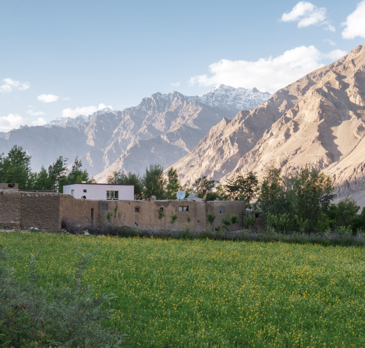
In Afghanistan’s north-eastern corner, the Wakhan Corridor is a severely mountainous location. River valleys that link the Pamir, Tien Shan, Karakorum, and Hindu Kush are adorned by rugged, rough-walled mountains. Kyrgyz and Wakhi nomad herds also remain in the corridor’s deepest valleys, leading very simple lives. The region has remained largely unchanged due to its remoteness. For its inaccessibility, the region has remained intact by technological development and urbanization, making trekking both demanding and satisfying.
The U-shaped mountains, which have plenty of chomping grass in the summer, are, however, covered in snow for up to six months. The Big Pamir (Pamir-e-Kalan or Pamir-e-Buzurg) and the Little Pamir (Pamir Khurd or Pamir-e-Kochak) are two immense meadow areas in the Wakhan. The semi-nomadic Wakhi use these valleys throughout the summer and return to their villages in the winter. The Kyrgyz are permanent inhabitants of the Pamirs’ highest altitudes. Despite the fact that the Little Pamir has a greater area, the Big Pamir is what draws tourists and trekkers to the corridor.
Given the fact how Afghanistan is one of the world’s most diverse countries, the Wakhan corridor is mostly populated by Wakhi and Kyrgyz. Wakhi and Kyrgyz people live primarily along the Wakhan corridor. On the Tajik side of the river, the Wakhi, also known as the Pamiries, are Shia Ismaili Muslims, a subbranch of Shia Muslims. They generally speak Wakhi, although the majority of them can still communicate in Persian. Because of its inaccessibility, poverty is still prevalent in the corridor.
The Shughni people, who originally lived on both sides of the Afghan-Tajik frontier along the Panj River (Oxus), make up the bulk of the Ismaili Muslims in Northeast Badakhshan Province. They used to have small kingdoms that dominated over almost all of Badakhshan. They’re well-known for their culture of liberty and education. Their rich ceremonial rituals and festivals have taken the Afghanistan by storm.
Echo trails was established in 2011 by Adab Shah Gouhari – one of the only eleven Afghans to ever ascend Noshaq – to help growth of tourism not only in Wakhan area but also all over Afghanistan. The contribution of the management team and the professional tour guides for the establishment of the company stretches back to years of efforts and dedication. Headquartered in Wakhan/Ishkashim area, Echo trails is a pioneer company which is fully staffed by locals. Their rich local knowledge and experience enables the company to offer the most authentic and rewarding tourism experience to our adventurous tourists.
Rather than guided tours with set daily plans, Echo trails offers expeditions with framework itineraries.
The following is an outline plan for this epic trekking expedition – it’s more about the “substance” than the “details.”
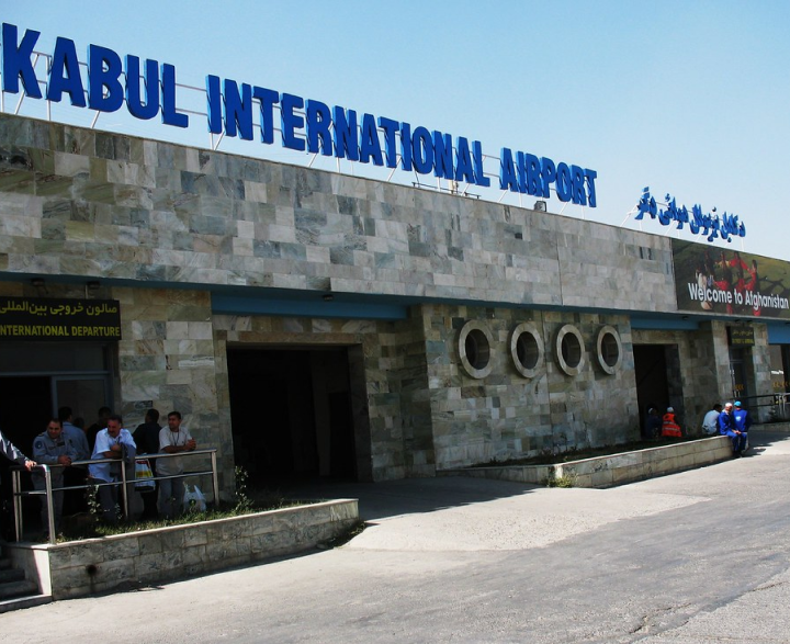
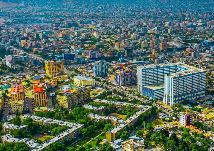
Arriving in Kabul at 0900 on July 26 2021, you will be met by your local Afghan Tour Guide and have an introductory session. You will spend the first two days in Kabul by visiting the many monuments and museums of Afghanistan as well as the famous gardens of King Babur of the Mughal Empire. In the following day you will fly to Faizabad, where a rough road will take us through stunning valleys into Ishkashim.
Your first day in with the villagers starts in Ishkashim. Our team of the Afghan local guides will accompany you from hereafter to the base camp. An expert will guide you all the way to the peak and back. Even after having cleared immigration & customs there will be still be some further red tape to clear, so patience will be needed.
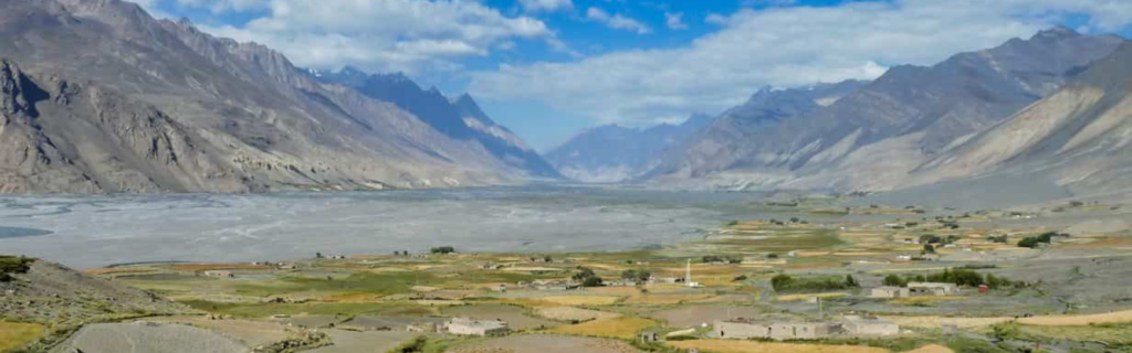
Our first day in the Wakhan Corridor takes us literally to the Qazideh Valley which is the entrance to the Peak. In Qazideh we will acclimatize a day or two depending on the adventurous spirit of the team, and from here, any further progress must be made on foot!
The journey is 37 kilometers long and needs three days and two nights to complete. It is not advisable to trek in a hurry because ascending to 4600m in less than two nights is a major jump and can induce high altitude sickness. Porters are equipped with food and rudimentary sleeping covers. It’s likely that during the rainy season, we’ll have to fit them in our tents. It’s also worth mentioning that there can be minefields that aren’t labelled. They’re near the first camping site, but they could be elsewhere too. So, for the first 15 kilometers, it’s best to stick to the road. We and the locals have thorough experience of the fields that may contain mines.
The hiking is fun, smooth on the rock boulder, and there are few challenges. On the road, there are several camping opportunities.
We should arrive in BC on the third day before noon.
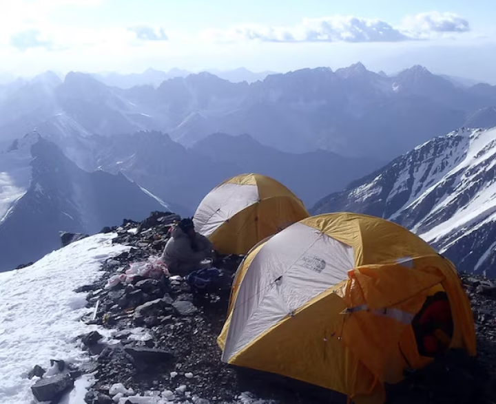
The base camp (4600m) is situated in a harsh setting. Rocks, sand, and wind are all that remains. Since the air is so dry and dirty, the mucous will be completely ruined, and frequently wiping your nose will become routine. There are tenting areas in BC, as well as several stone-built temporary structures. They can be used as a kitchen or a windbreak for our tents. On the other side of the camp, there are two latrines. Water is available on the camp’s upper level.
The weather is consistent, with a few minor surprises. If it does not snow in the morning, the day will most likely be sunny. The afternoon would most likely be gloomy, with the possibility of snowfall. As a result, the safest time to begin climbing is very early in the morning and proceed until 14:00.
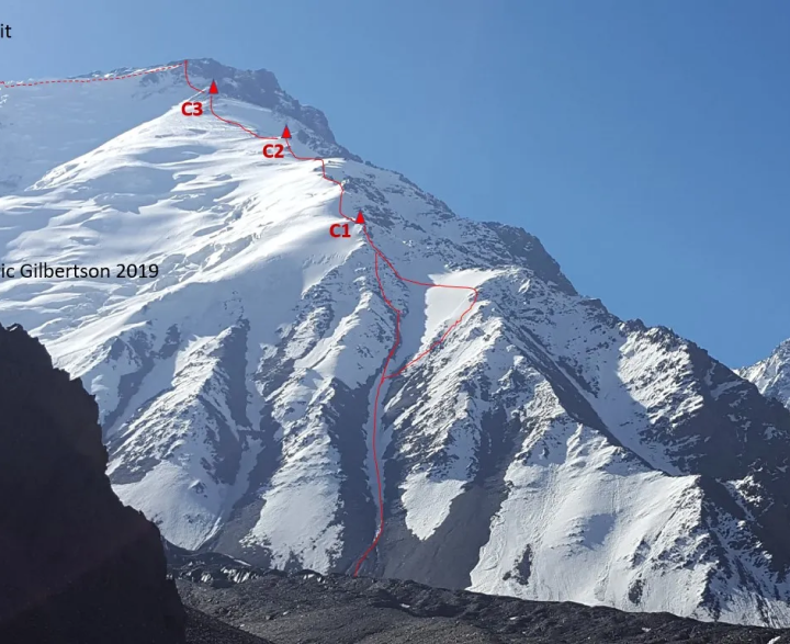
It takes about an hour to walk below the wall from BC. The climb begins with a 1000m long, narrow couloir. There is a risk of dropping bricks, so be cautious and, if at all possible, wear a helmet. Despite its appearance, the couloir is relatively straightforward to climb with crampons. C1 plateau is located at 5400m at the end of the couloir. It's a beautiful spot of snow to melt.
After this, it's a straight ascent that's mainly steep snow walks with some camping options. At 6000, there is a C2- with a small water tank. At 6200, the official C2 camp is situated. Both are magnificent due to the fact that they are shielded from the wind by the stone wall. The temperature for the 7k peak should be very good. It could be nice up to 25 degrees during the day and it's about 5 and -5 when it's gloomy. The temperature at night is about -10 degrees Fahrenheit, but it can decrease to -17 degrees Fahrenheit in C3.
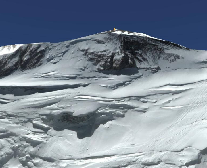
The walk from C2 to C3 is monotonous, with snow fields and stone piles thrown in for good measure. C3 is located just under the key stone wall that must be scaled. C3 is at 6900 feet, and the wind has earned it the nickname "worst spot on the planet." In our experience, the C4 just above the wall should be preferred. The wall can be climbed from either the left or right side. The overwhelming majority of those who ascended the right. The majority of people who climbed the correct route say that they will climb the left route next time. Our guides ascend the correct path, which has a difficulty rating of 3+. Fixed ropes are not needed for a professional rock climber. On the way out, though, we'll have some for rappelling. After reaching the top of the rock, we must walk the remaining 1000 meters along the ridge to reach the summit. In dense snow, the final walk can be demanding.
Since arrival in BC, the average time to reach the summit is about 20 days. We only ascended for 12 days the last time, so certain shortcuts are probable.
Descending is a simple process. It is possible to summit and travel to BC in a single day, but it is better to spend the night in C1. It is also possible to arrive in Qazideh in one day, but to make things easier, let’s go to lower camp for a good night’s sleep and return the next day.
In Qazideh, its time for a feast! Let’s go for an exquisite and traditional Wakhi-Style Kababs and meal. We will be greeted by locals and most probably be gifted with Chapans (Long-sleeved Afghan overcoats) and flowers for achieving the extraordinary championship. Bravo Champion!
Your arrival to Dushanbe, Tajikistan will be 0900 on 05 July 2020. You will be received by the expedition guide at the airport and have an introductory session. The first few days in Tajikistan will take us along the famous Oxus river to GBAO and the crossing point to Afghanistan. The road hit is a long road trip (approximately 20 hours) via the astonishing Pamir Highway to Badakhshan. On the fourth day you will cross the border to Ishkashim, Afghanistan. Welcome to Afghanistan! With lots of paper work and bureaucracy the trail of silk road starts to take you through the wonders of the spectacular Wakhan.
On the return from Wakhan, our final full day in Afghanistan sees us return to the border town of Shughnan and Khorog. There should be time for some final shopping opportunities before our final hours in Afghanistan.
After the excursion, you will surely have a lot of memories and experiences to share with others. It would be a once-in-a-lifetime opportunity for you. You will not only be introduced to a range of living conditions, but you will also see how people live in one of Afghanistan’s most deprived and naturally beautiful areas. You may have the opportunity to engage with locals and will make some new friends (s). We will make every effort to make your visit rewarding and memorable.
There will be a closing session in which both team members will provide a short overview of their experience. This would be an occasion for all of us to focus on our collaborative efforts as well as our unique experiences. This session will also help us to collect your input in order to enhance our future service.
Anyone in good health who has an open mind and a sense of fun should be able to handle this tour with ease. Please keep in mind that, while this ride is not very strenuous in terms of physical exertion, the remoteness and roughness of the road can be taxing and should not be taken lightly.
We may ride horses in a contingency day and throughout the Buzkashi game.
Yes, Teammates with dietary requirements are welcome to join. However, local food supplies are limited and we should be aware of your needs in advance.
Yes, but not during the whole excursion. Especially, in the upper Wakhan access to power is very limited. It is recommended that you carry small solar panels if you need to charge your electronics all the time.
Is it safe to just solo backpack around Afghanistan as a tourist? Certainly not. The risks are simply too great. Is the situation on the ground in a constant state of flux? Yes, it is and risks must be measured regularly, as the situation on the ground changes quickly? But is it impossible to visit as a tourist? No, that’s not true either. It is possible to visit Afghanistan with well-managed risk mitigation if you plan accordingly. Here’s how.
Not during most of the excursion. However, we will carry a phone with us in case you need to make emergency calls.
Yes, most nationalities need visa. Since this trip will take place through Tajikistan, you will need a visa for both countries. For Tajikistan you also need a GBAO permit (Gorno-Badakhshan Autonomous Oblast) to enter southern Tajikistan. For the Afghan Visa we will send you letters of invitation upon request. Visas are teammates’ responsibility.
No, this trip will be more convenient through Tajikistan and you will fly to Dushanbe.
Yes, for the most part. In Tajikistan it is acceptable to expose arms or legs, but the same is not recommended on the Afghan side. It is recommended that men wear long trousers and long sleeves. Women should cover legs and arms and wear a headscarf while visiting the villages. When trekking on the mountains you could remove your scarf.
Apply for this expedition team using the button below. Contact us to find more about the joining process, advice on kit, fitness, visas, flights and travel insurance. Echo trails is then on hand to help with your unanswered questions or to firm up your place on the team.